 Disney Tips Your Guide To A Great Disney Vacation
Current Status of Hurricane Erin
Hurricane Erin has intensified into a Category 3 storm, exhibiting sustained winds exceeding 125 miles per hour. According to the National Hurricane Center, it resides approximately 155 miles north of San Juan, Puerto Rico, and around 310 miles east of Grand Turk Island. The storm is moving westward at 14 miles per hour, raising alarms for nearby regions, especially the Bahamas, which the National Hurricane Center has flagged as particularly vulnerable.
As Erin approaches, residents in impacted areas should prepare for strong winds and high seas along the East Coast, stretching from Florida to Virginia. Heavy rainfall is anticipated, with some places like the Dominican Republic and Haiti expecting up to six inches due to Erin’s outer bands.
Shift in Erin’s Forecast Path
Forecasters have noted significant changes in Hurricane Erin’s predicted trajectory. Initial forecasts indicated a northward turn, suggesting the storm would entirely evade the United States. However, the National Hurricane Center recently revised this path further south, raising concerns for Florida’s coastal areas, although Central Florida still seems out of the immediate danger zone.

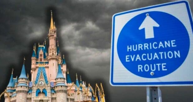
This modification in the storm’s forecast trajectory has led to heightened worries among residents and visitors, particularly those planning trips to Central Florida attractions like Disney World. Despite Erin potentially missing Central Florida directly, the possibility of severe weather disturbances remains, leading to warnings for strong gusts and increased coastal tides.
Monitoring of Additional Tropical Systems
In addition to Hurricane Erin, the National Hurricane Center monitors two new tropical systems. One of these systems is positioned off the Carolina coast but too far north to pose an immediate threat to Disney World vacations or Central Florida.

However, the second system forming off the west coast of Africa shows potential for development and is being watched closely. While it currently retains only a 20 percent chance of intensifying in the coming week, it could gain strength if it enters the warmer Atlantic waters, similar to Hurricane Erin’s evolution. The National Hurricane Center emphasizes ongoing vigilance regarding these systems, as conditions can shift rapidly.
Implications for Central Florida Residents
As the situation unfolds, residents and tourists in Central Florida need to stay informed. The National Hurricane Center provides real-time updates crucial for understanding potential weather conditions. Given Disney World’s status as a significant regional draw, weather-related disruptions could significantly impact travel plans and park operations.

Visitors are advised to prepare for unforeseen changes by implementing reliable communication strategies and assembling emergency kits, even if the immediate threat appears manageable. The developments surrounding Hurricane Erin and the two additional systems underscore the importance of readiness during hurricane season, as unexpected changes may arise.